It was a busy and productive summer for the Great Divide Trail Association! Here’s what we’ve been up to…
Trail Maintenance 2015
From July 15 to 19, the Great Divide Trail Association partnered with the Hornaday Wilderness Society, the trail operator for the Aldridge Creek Trail. 18 volunteers worked to re-establish the trail from the Aldridge Creek trailhead to Fording River Pass, repairing and building trail tread, and removing brush and fallen trees.
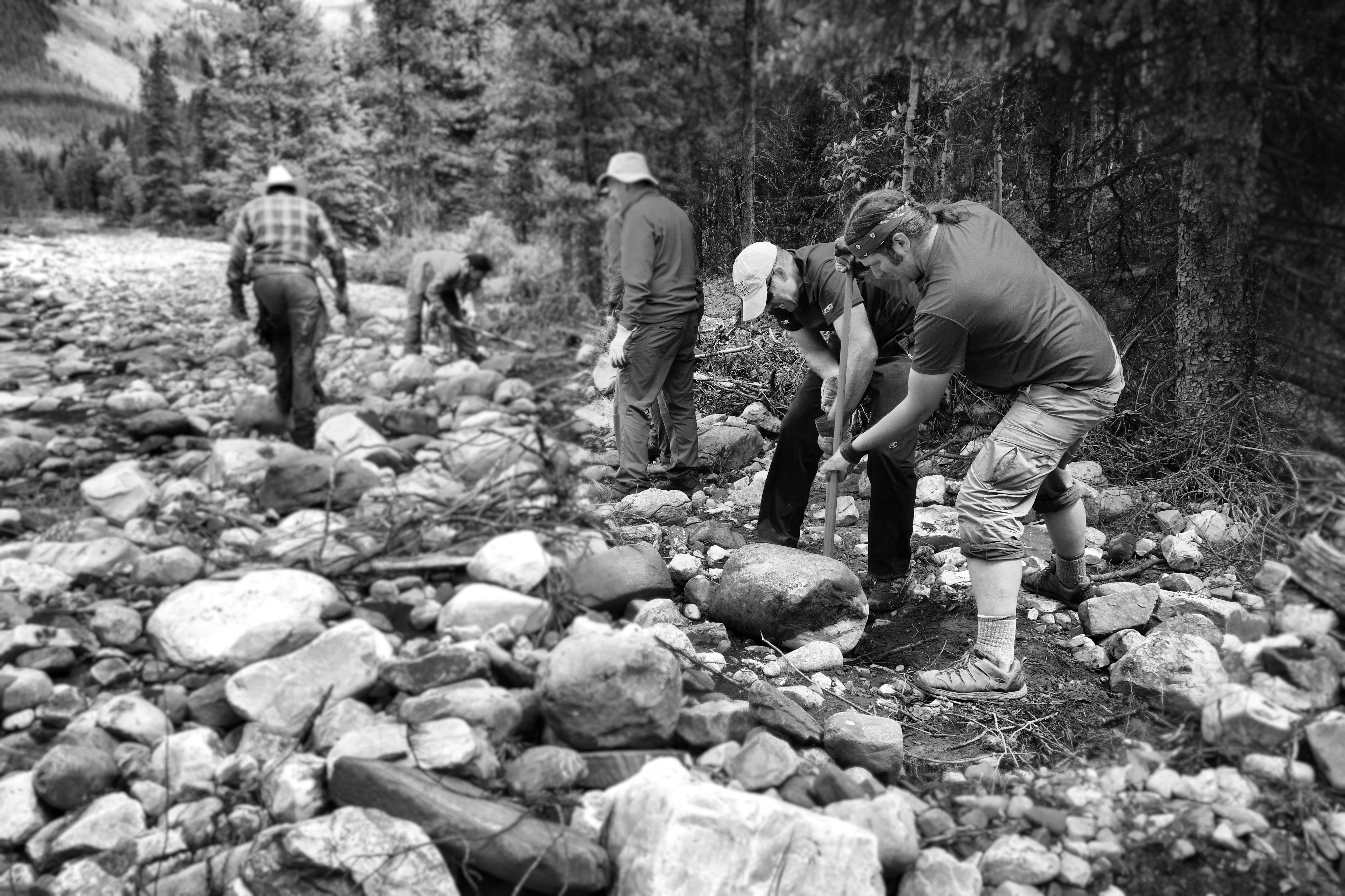
Boulder rolling on Aldridge Creek
The lower section of the Aldridge Creek Trail was washed out in 2013 when a massive flood increased the flow of the creek exponentially. After the flood, only remnants of the original trail remained on the huge gravel floodplain. Our crew cleared boulders and debris and re-established the trail in the lower valley. This work involved the use of shovels, mattocks, saws and loppers. A new crossing of Mud Creek was built, good for hikers and horses.
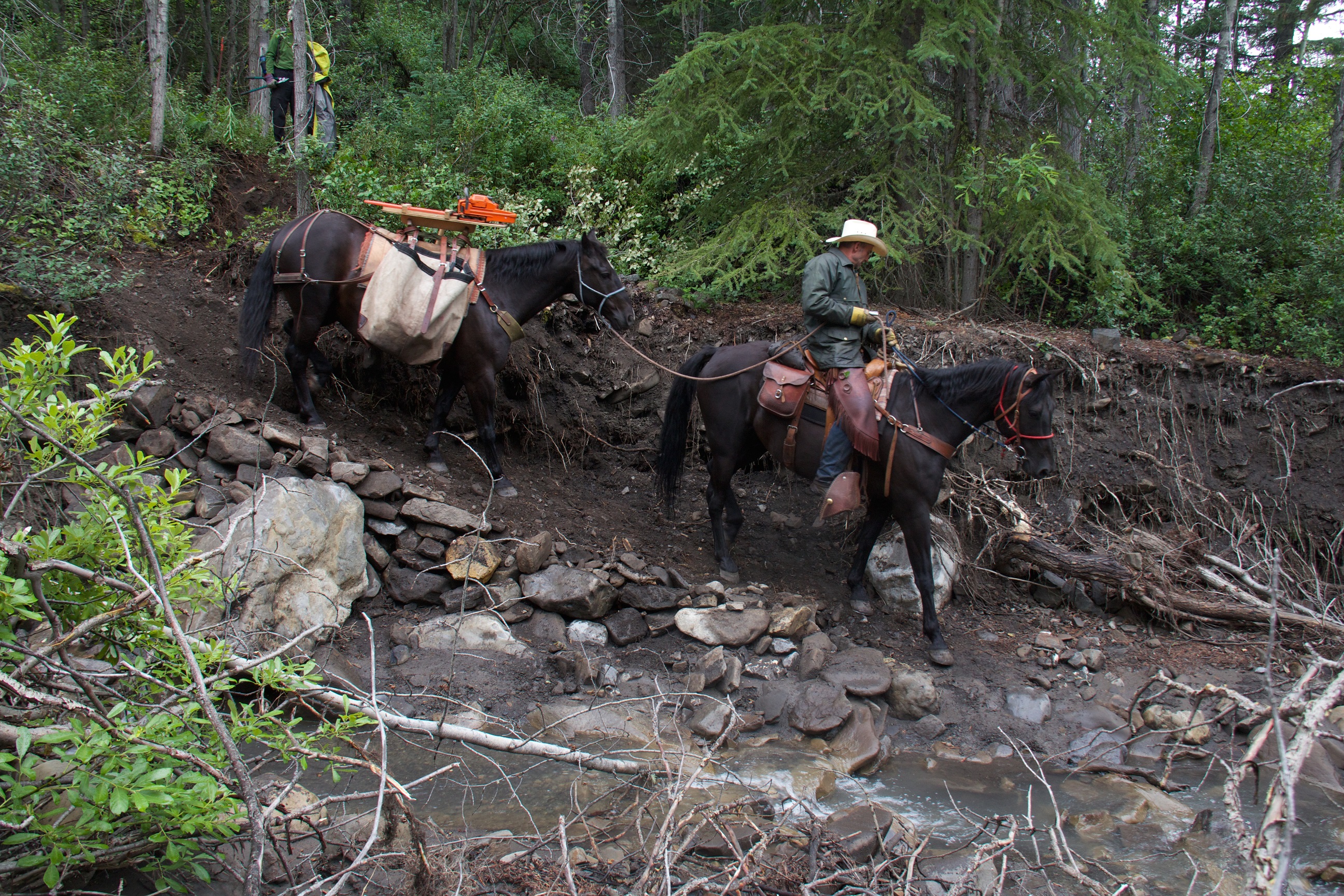
New trail at Mud Creek
The upper section of the Aldridge Creek Trail was overgrown with alder, often completely disappearing beneath the encroaching brush. Two Stihl brush saws and hours of sweat and hard work were needed to clear more than 3 kilometres of trail corridor. We had expected it to take 2 days to clear the overgrown trail but it ended up taking 3 full days to re-establish the trail up to Fording River Pass.
On Days 2 and 3 of our trip, we were greeted by 4 happy thru-hikers, all excited to see us clearing and repairing what had been a notoriously bad section of the GDT. We met Gian and Laura on Thursday and Erin and Elizabeth on Friday. It was very rewarding for our crew to meet these thru-hikers and see what a difference their efforts can make. Check out Erin’s blog where she writes about her experience meeting our GDTA Trail Crew.
And at the trailhead we installed our first ever routered GDT sign!
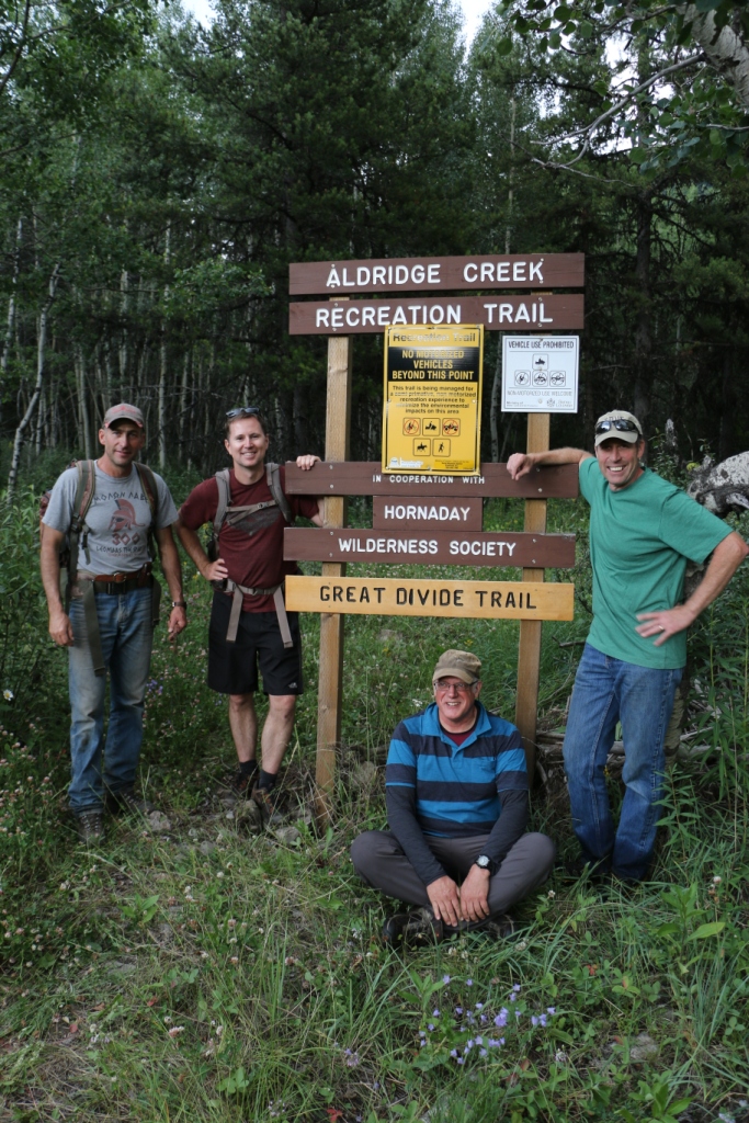
The trailhead sign
Thanks to all of our dedicated volunteers who participated in this year’s GDT Trail Maintenance Trip. Your hard work and enthusiasm made for a hugely successful trip!
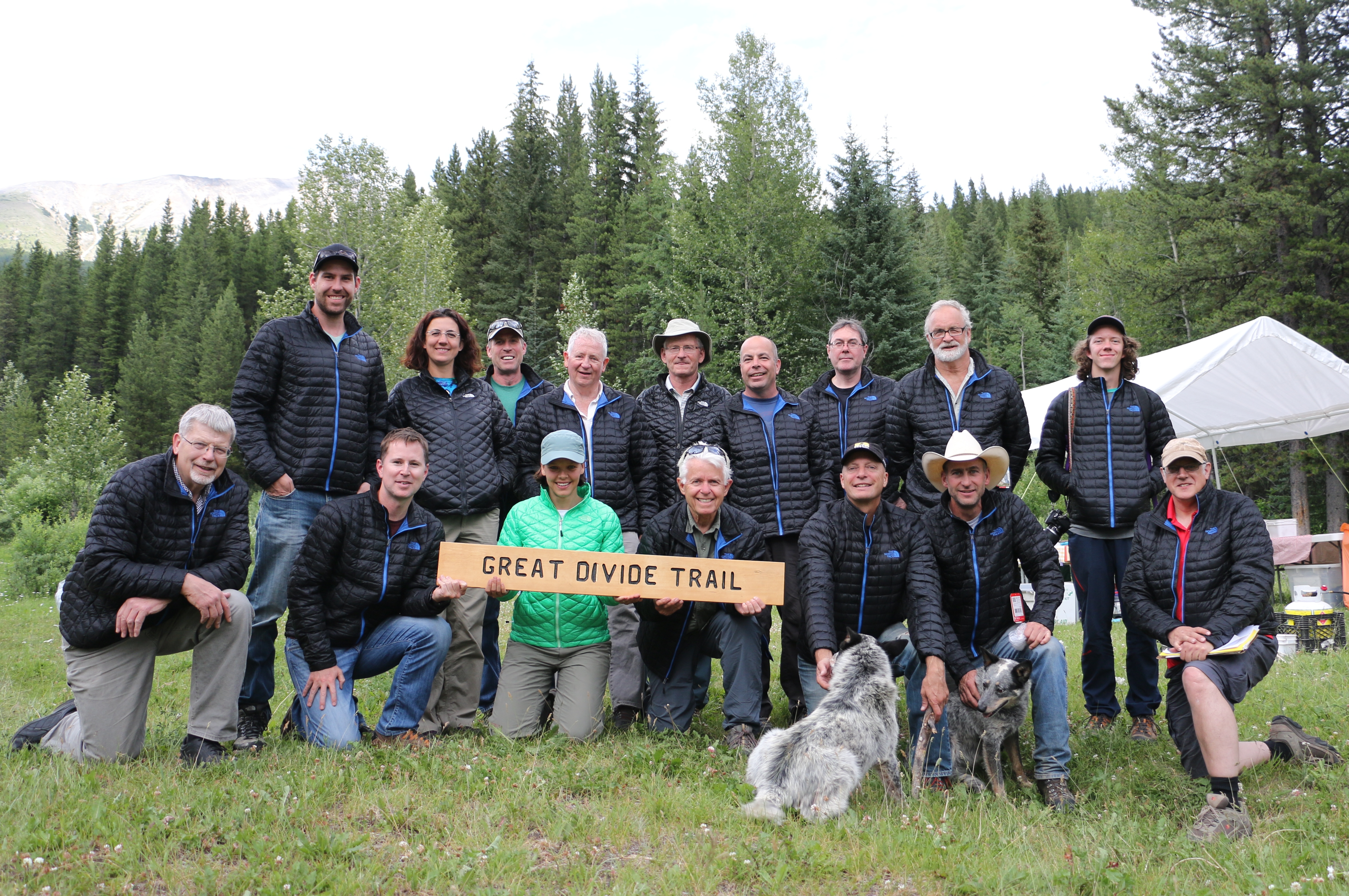
The GDTA Volunteer Trail Crew
And special thanks to our sponsors for making our trip possible.
![]()
The GDTA Blog
“Oh the Peaks You Will See!” by Jen Peddlesden
Third in a series on the mountains along the Great Divide Trail
You will see KISHINENA PEAK to the west along the Cameron Lake to Sage Pass Section of the Great Divide Trail as you pass Twin Lakes, or stay at the Twin Lakes Campground.
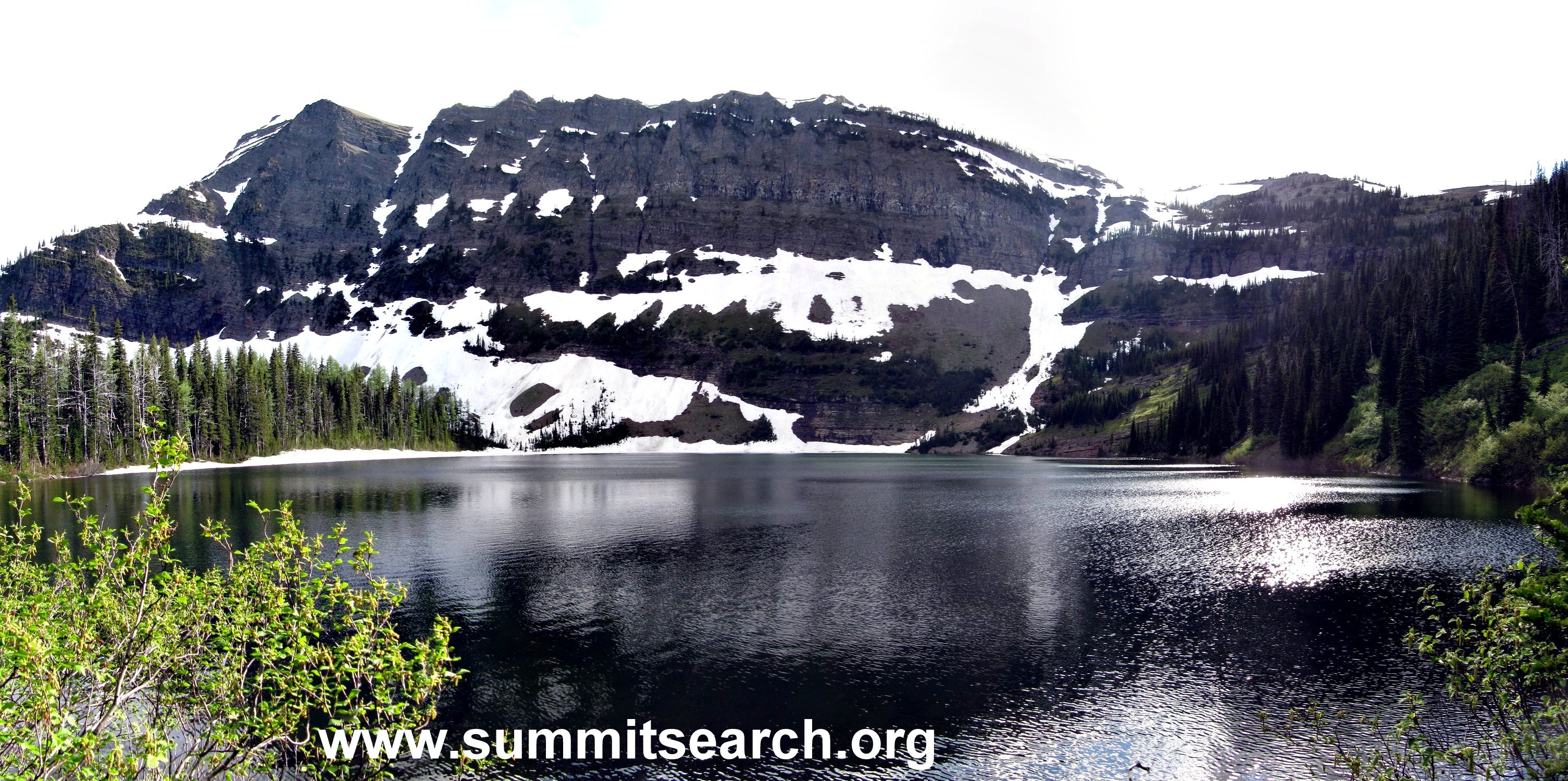
Kishinena Peak (photo by Eric Cloutard)
The peak (2436m /7993ft at Latitude 49; 07; 03 Longitude 114; 08; 58, Topo map 82G/01) is part of the continental divide at the headwaters of Lone Creek. Kishinena Peak is the north buttress of South Kootenay Pass and is one of the 25 named peaks located in Waterton Lakes National Park. Officially named in 1959, “Kishinena” is a Ktunaxa (Kootenay) First Nation word meaning “white fir” or “balsam”. There is another possible origin: The name Kishinena may be a corruption of the First Nation word, “ish-nee-nee” which means “there it is”. Evidently, the survey party was looking for water, and the Kootenais who crossed the summit with them answered saying “ish-nee-nee” and the survey party did not understand the proper pronunciation or translation.
Dustin Lynx, author of ‘Hiking Canada’s Great Divide Trail’ says about this section: “this high level hike, adjacent to the Continental Divide offers an almost continuous panorama. This segment known as the Tamarack trail is my favourite hike in Waterton Lakes National Park…”
Kishinena Peak also lends its name to a BC park with spectacular scenery. In 1995, Akamina-Kishinena became a Class ‘A’ provincial park. The trails and passes of Akamina-Kishinena Park were used for many years by the early peoples and wildlife travelling between the Flathead River Basin and the abundant Great Plains.
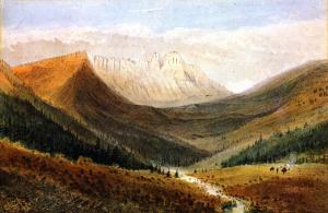
In 1860, James Madison Alden, a 26 year-old artist who accompanied the boundary survey, painted “In the Kishinena Pass” a watercolour held in the collection of the Glenbow Museum, Calgary.
“The Little VW That Could” (or “How We Skewered a Volkswagen”) by Dave Higgins
All the recent brouhaha surrounding Volkswagens rigged to pass emissions testing brings to mind the time we had our own jury-rigged VW, which is a much happier story as it was instrumental in helping us survey the original route of the Great Divide Trail.
In the lead up to our 3-month-long trail study project in 1974 (which resulted in a final GDT routing plan between Waterton and the Kananaskis area), my five colleagues (Mary-Jane Cox, Jenny Feick, Chris Hart, Cliff White, and Dave Zevick) and I found ourselves short one suitable vehicle for transport to and from the various study areas along both sides of the continental divide. By “suitable” I mean something capable of traversing hundreds of kilometers of rough backroads, fording rushing creeks, and carrying up to four people plus backpacking gear. But I also mean something that could be had for no more than $100, which, of course, would immediately exclude anything reliable enough to do the job. Good thing we were all too young and naïve to realize that!
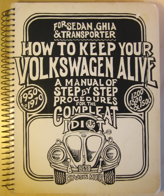
As luck would have it, Chris located and purchased what seemed like the ideal candidate: a sky-blue 1962 VW “notchback” sedan. A bit on the small side, maybe, but it had a killer feature: you could put packs in both the front AND rear trunks, or under both the bonnet and the boot if you happen to be English (the location of the engine wasn’t entirely obvious, at first). Chris also scrounged the most user-friendly maintenance manual I’ve ever seen, appropriately titled “How to Fix Your Volkswagen, for the Compleat Idiot” – a thick tome filled with hand-drawn illustrations, earthy advice on love and the proper use of torque wrenches, and the admonition to “Be kind to your ass, for it bears you.”
A bit rusty here, there and everywhere, our new acquisition wasn’t in terrible shape – well, not after we patched a gaping hole in the floor with a piece of plywood. At least the engine ran, and the brakes and lights seemed to work, most of the time. Shifting the worn-out gearbox, however, required a new skill: “double-clutching” – a complex sequence of clutch-and-accelerator applications. But the good news? Chris underspent the budget by half!
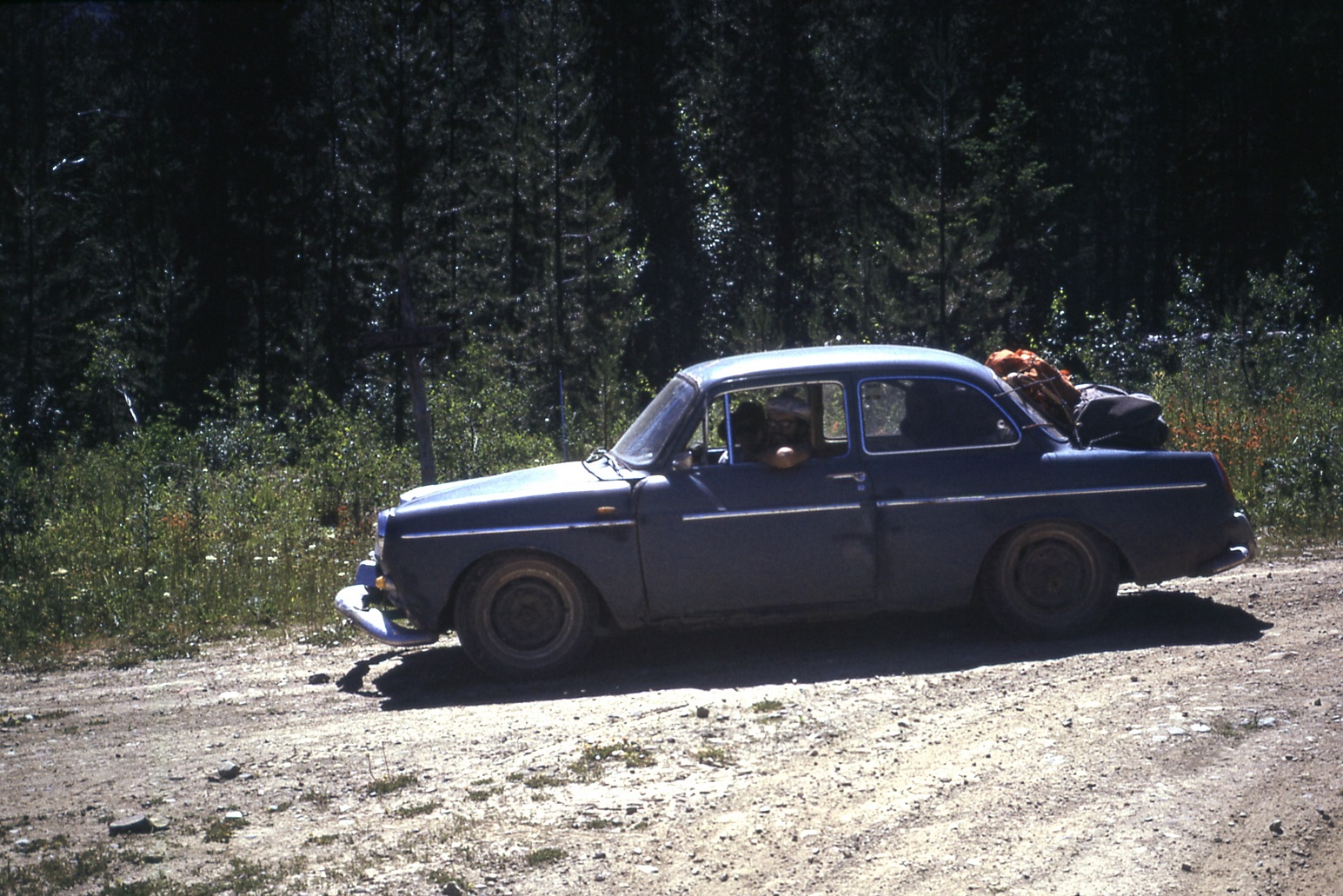
Looking (almost) ship shape!
Confidence built when “Blue,” as Chris dubbed the car, made the trip from Calgary to Crowsnest Pass without trouble. Week One of the project found Jenny and me surveying the area just north of the Pass. We’d dropped off Chris and Dave in their assigned area a few days before, Chris warning me to take good care of Blue. We were descending the switchbacks of the old Vicary Mine access road, yours truly at the wheel. I didn’t think anything of it when Blue brushed the underside of a dead lodgepole pine overhanging the road in the same direction as our travel, and later that day we headed back up the steep road, in second gear with the engine roaring in complaint at the effort. Rounding a bend, I spotted the overhanging pine and, remembering how we’d slid neatly under it, kept going, pedal to the plywood. Not smart. The tree must have settled a bit lower from our previous passage, because this time the brittle tip caught on the windshield molding and broke right through with an enormous crash and spray of shattered glass and branch fragments!
When at last all was still, I glanced past the tree trunk in the direction of my partner, half-expecting the worst, and was relieved to see her staring back at me, albeit with an expression of pure shock on her face. “I didn’t want to look,” she exclaimed. “I thought your head would be missing!” I almost replied no, I’d already lost it before we even got near the tree. But we’d been spared, this time at least. We quickly exited to survey the damage, shards of glass and piles of sticks and bark falling from our laps. It was NOT a pretty sight!
The long straight tree trunk had gone right through Blue! Or, more accurately, I had managed to skewer the car like a big chunk of beef bound for the grill. The top 2 metres of tree trunk protruded from the rear passenger side wheel well, right above the tire. What a sight! “I must have kept the gas on,” I explained, rather lamely. “I’m sorry!”
“Well, I’m just glad we’re both alive,” Jenny said with relief in her voice, “but Chris might want to kill you for wrecking his pride and joy!”
“It doesn’t look THAT bad,” I lied. “Maybe we can back it off the tree.” Fat chance, I thought, but worth a try anyway. So I got back in, and when Blue’s engine started right up I took it as a good sign. It was a bit more than the usual three minutes finding reverse, but then the car slowly extracted itself, assisted by the gravity of the steep hill. Then it was just a matter of removing the remaining windshield fragments and cleaning up the mess, then driving to the meeting point to pick up Chris and Dave.
Jenny was right – Chris DID want to kill me. But I promised to buy a new windshield and we amused ourselves on the way back down the Forestry Trunk Road to Crowsnest Pass by standing and waving at all the passing vehicles through the new opening, the person in the passenger side rear given the job of holding a towel over the other new opening to keep the dust to a minimum. In the Pass, however, it was raining so we turned on the wipers to avoid attracting attention from passing RCMP cruisers, certain that if we were ever pulled over our precious car would be impounded as a hazard. And that was only the start of the fun!
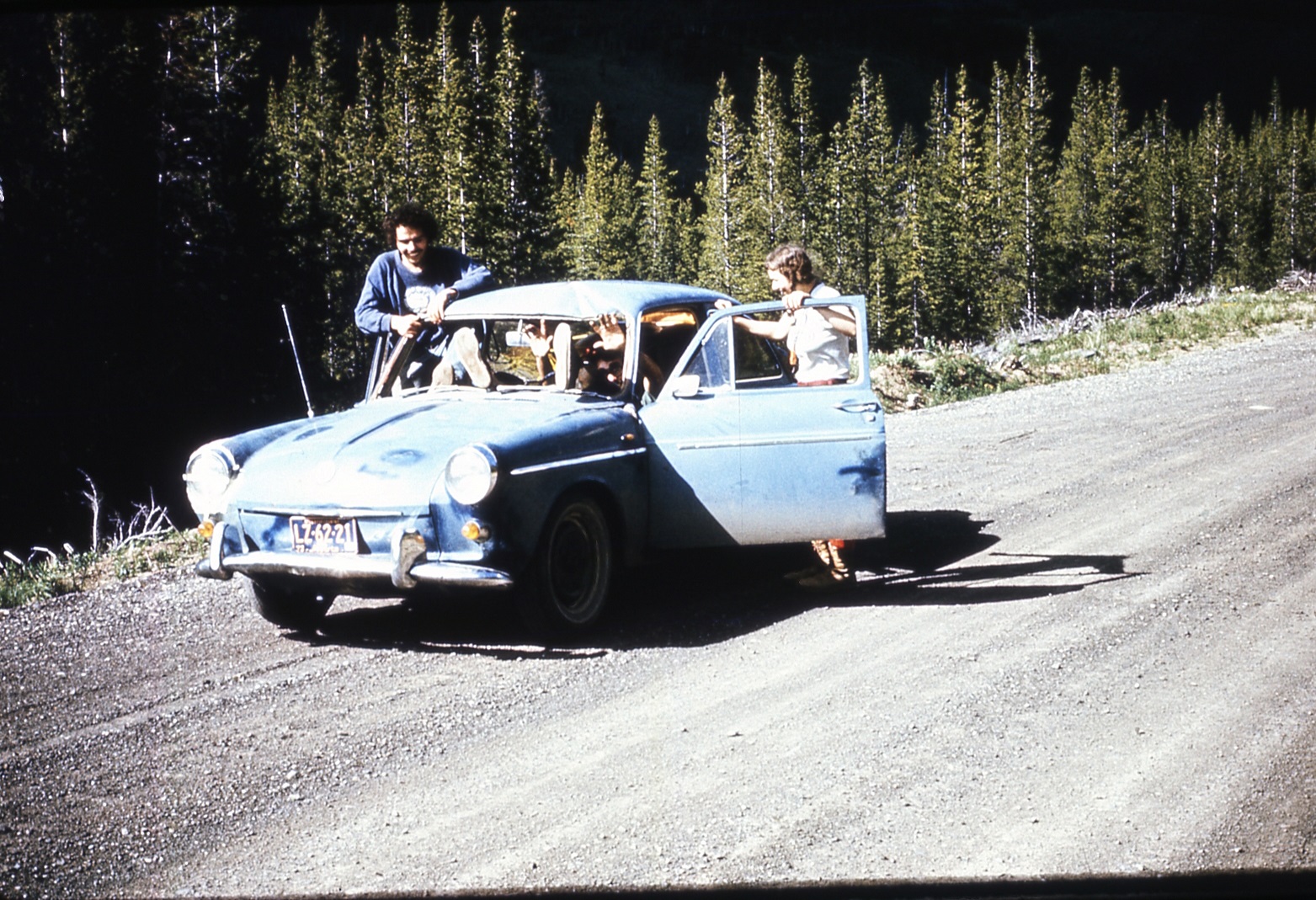
Look Ma, no windshield!
Read more about Blue and his role as an indispensable member of the 1974 GDT survey team.
GDTA 2015 AGM
This year the GDTA’s AGM was graciously hosted by the Alberta Wilderness Association. Over 50 people were in attendance to hear about our productive 2014-2015 year protecting, promoting and maintaining the Great Divide Trail.
Our special guest Dustin Lynx, author of Hiking Canada’s Great Divide Trail guidebook, presented his adventures pack-rafting and solo hiking in Canada’s Northern Rockies through the Muskwa-Kechika wilderness. Thanks to Dustin for drawing the unprecedented number of guests to our AGM with his presentation and continuing to share his passion for the GDT!
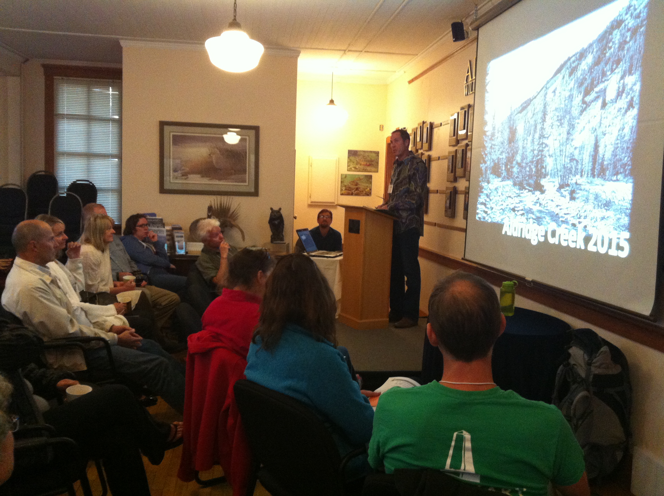
Dustin Lynx presenting at the GDTA AGM
We also recognized several volunteers who have played a significant part in the success of the GDTA this year. Doug Borthwick, Jean-Francois Cianci, Meagan Odell and Kathy Plachta were recipients of GDTA Pride and Recognition Awards with prizes courtesy of The North Face.
The more official business of the AGM saw a new bylaw passed for new membership categories. The GDTA will now have Individual (30$), Couple (50$) and Family (70$) annual membership options. The GDTA Board of Directors also underwent some changes. After a vote, the board is officially at capacity with 11 board members. Welcome to our 4 new members: Darrell Aunger, Julie Aunger, Kathy Plachta, and Christine Smith! We are all looking forward to working together and building on the momentum of this positive and productive year for the GDTA.
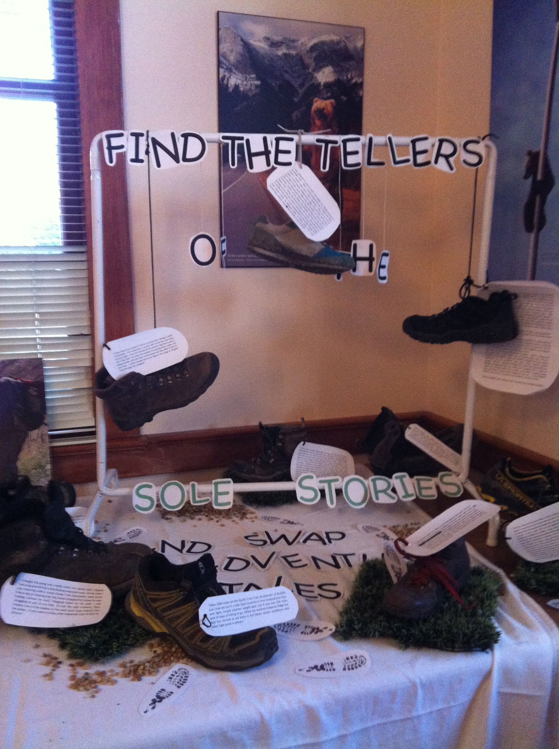
AGM Sole Stories
Thank you to all our members, sponsors and volunteers who have supported our organization over the past year. We encourage you all to get out on the Great Divide Trail and create some more sole stories to share with us at our next AGM!
Trail and Road Conditions Update
The GDT has experienced an unusually long fall hiking season but winter is coming! Expect fresh snow and wet or icy trail conditions, with temperatures falling below freezing. Conditions can change quickly so be prepared for all weather conditions when travelling into the backcountry this fall.
SEASONAL CLOSURES:
- Jasper National Park: The GDT is closed from Four Point Campground to Signal Mountain Trailhead from November 1, 2015 to February 28, 2016, to prevent trails from facilitating an unnatural level of predator access to threatened woodland caribou.
TRAIL CLOSURES:
- Elk Lakes Provincial Park: Extensive repairs and construction on the trail between Lower and Upper Elk Lakes to be carried out throughout 2015 hiking season. Detour to West Elk Pass by taking the Elkan Creek trail from the parking lot trailhead. Lower Elk Lake campground is still accessible but hikers are asked to exercise caution in this area during construction.
TRAIL NOTICES:
- The trail from Sage Pass (a17) to Scarpe Pass (a24) was cleared and blazed in August 2014 and is in good shape. From Scarpe Pass, the trail disappears up to La Coulotte Ridge and the hiking becomes significantly more difficult until you reach the ATV track (a27) heading down to the West Castle Road.
- The Aldridge Creek Trail between Fording River Pass (b31) and the Kananaskis Power Line Road (b32) was cleared and restored in July 2015.
- On October 7, 2015, a large landslide occurred on the relatively low angle western slopes of Mount Cautley, above the Lake Magog area in Mount Assiniboine Provincial Park. For public safety, BC Parks requests that visitors to the area stay well away from the site and stay clear of the slide’s run out downslope.
- Cairnes Creek (d9): The bridge is washed out making this a potentially dangerous ford. It is recommended to cross early in the morning when glacial melt is lowest.
- The damaged Lambe Creek bridge (d10) was removed in September 2015. It is recommended to ford the creek further downstream.
- The Howse Pass Trail from Conway Creek (d12) to the Glacier Lake trail junction (d14, 15 km) is in very poor condition. The trail is overgrown, with hundreds of wind-fallen trees across the trail. Hiking in the Howse River floodplain is a viable alternative if the Howse River is low enough to ford.
- The Owen Creek Trail was cleared in July 2015 up to km 6. Beyond that point, the trail is in poor shape with several washed out sections. Expect challenging hiking for 3 km including skirting along steep creek-side cliffs and rock-hopping in the creek itself. At km 6, do not take the trail heading up away from the creek (it is a deadend). Look for orange blazes marking the correct route staying near the creek.
- The Maligne Pass trail in Jasper National Park has been decommissioned and is in poor shape. The trail from Pobokton Creek (e20) to Maligne Lake (e25, approx 42 km) is no longer being maintained by Parks Canada so expect deteriorating and overgrown trail conditions; long pants are recommended. The Maligne River bridge has been removed but the river can be easily forded in normal summer conditions (knee deep in mid-summer). Most other bridges are still in place. Read Nathan Dahl’s August 30, 2015 Maligne Pass trail update here.
- The Yates Torrent Bridge is out at the crossing of the Coleman Glacier outflow (near f16). Attempt to cross early in the morning when glacial melt is the lowest or be prepared for a fast and potentially dangerous creek ford.
ACCESS ROAD UPDATES:
- Winter conditions exist on many mountain highways and roads. Roads can be snowy and icy so check for the latest conditions before you travel and carry chains and/or winter tires. For more information, check out Alberta 511 and Drive BC.
- Highway 40 is seasonally closed from Peter Lougheed Provincial Park to Highwood House beginning December 1.
- Forestry Trunk Road 940 is seasonally closed south of Cataract Creek and northwest of Plateau Mountain Road beginning December 1.
- The Red Rock Parkway in Waterton Lakes National Park is closed for the season until approximately May 2016 to allow for reconstruction of the parkway and the lower parking lot at Red Rock Canyon.
- Access to the northern terminus of the GDT in Kakwa Provincial Park is via the Walker Creek Forest Service Road. The Walker Creek FSR has been repaired from Highway 16 to km 33.5. While travelling the remaining 50 kilometres on the Walker Creek FSR, attention is required to navigate the surface as it is uneven, rutted, slippery and very rough. The road is not recommended for anything other than a 4×4 high clearance vehicle. The last 10km from Bastille Creek to Buchanan Creek are particularly rough and muddy and might not be driveable by vehicle so be prepared to walk this distance on foot.
GDTA Membership
The Great Divide Trail Association is a membership organization built by the support of people like you. We now offer three different types of memberships:
- $30 Individual Annual Membership
- $50 Couple Annual Membership
- $70 Family Annual Membership
GDTA Membership gives you up to date information and trip‐planning resources for the Great Divide Trail, voting status at meetings of members of the GDTA, eligibility to serve on the GDTA Board of Directors, invitations to participate in trail classes and volunteer trail projects, and the knowledge that you are helping to protect and preserve the Great Divide Trail.
Check out our website for more information on how to become a member today.
Thank you!
Brad Vaillancourt
President, Great Divide Trail Association